.JPG)
Hinckley Reservation “Hodgepodge” Hike around
the Western Sections
Includes the Hinckley Hills Loop
and parts of the Ledge Lake, Wordens Ledges and Hinckley Lake Loops
Wednesday March 15, 2012
I did actually have a plan today, yet my fate as regards
plans has seldom gone according to any script. Today was
no exception. If you come out here to roam the back trails
you’ll want to bring a map, a compass and a really good sense of direction.
At least at the time I came I found that the map was a good general guide but
that there were numerous
trail intersections that didn't appear to be on it. It also looked
to be completely off when it came to the interaction between the Wordens Ledges
and the Ledge Lake trails. Wrong turns were also fairly easy to make since the paths themselves
were generally only marked at
the beginning and at the ends. Please be very careful and very alert.
My intention this day was to travel around the perimeter of the park on a combination of different paths, starting on the westernmost side of the preserve so I parked in the second lot after the park entrance (directions are on the above website). There’s a first parking lot on the left and then there’s a second one on the right. It’s in between these that the Bridle Trail begins on the right side of the road. You’ll set off on this path through the pines as you wind around the edges of a field. Today the trail turned out to be very muddy.
Let me state that I never set out to travel on muddy
trails. I like to wait until they dry out a little bit so
that I don’t mess them up any more than is necessary, but if you encounter a
situation like this you have no choice as an ethical hiker. You don’t want to
avoid the mud on the trail and step around it. Doing so will spread out the trail
erosion further into the natural
environment. You’ve got to go right through the middle of the
muck on the most direct route possible while stepping on any sticks, rocks and/or roots that
are available to assist. Proceeding in this fashion gave my
tennis shoes a real workout and mud coating (I'd misplaced my hiking boots)!
Anyway, it was in the midst of this first section that I
got an idea of just how confusing things would be today.
What looked like an old path came up from the right with a sign that
indicated the area to be closed for natural resource restoration.
Well, if the map was correct (and I was still assuming it was at this
point) then this was the start of the Hinckley Hills Loop Trail.
If it was closed I thought I might have to mark this section off my list…
Or not… As I left the field behind to
enter the woods I came upon the first legitimate trail intersection.
A sign here indicated that the Hinckley Hills Loop Trail (marked with an olive
colored bird silhouette) began by breaking off to the right. The
Bridle Trail (marked in yellow) continued straight. Well, I
have no idea why I didn’t take the right... There must have
been a reason but it escapes me now. What I did here was
follow the Bridle Trail a short distance to the next “T” intersection and from there I followed the Hinckley Hills Loop in the
opposite direction. You can do this too if you
want – you’ll just pass over this short stretch twice – but you will be making
the entire 2.5 mile loop as opposed to doing just a part of it as I had
originally planned.
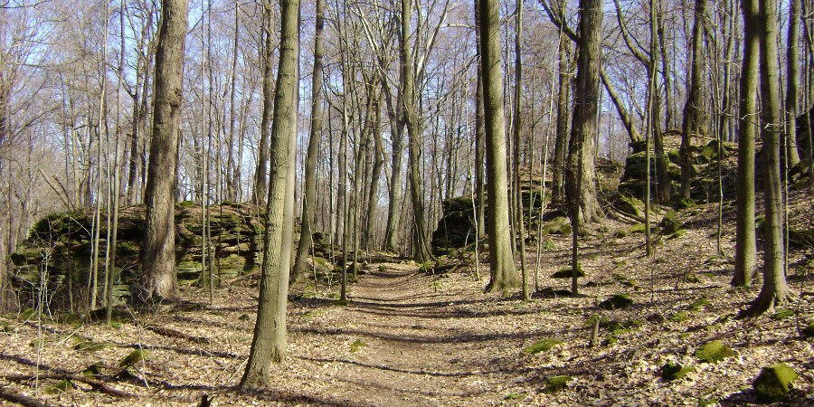
Of note is that you’ll actually be linking up with a portion of the Buckeye Trail here by taking a right at this “T” to begin a light ascent up to the top of a ridge. The Buckeye Trail is a 1000+ mile path that travels through Hinckley Preserve as part of its circuit around the state. Incidentally, you’ll note throughout the day that the paths out here are so consistently wide that they’d make for great summer hiking – you wouldn’t have to worry so much about brushing into foliage and catching ticks. Not only that, but you’re likely to be shaded by the tress with room enough for a nice breeze to cool you off.
The Buckeye Trail will split off to the left through a
clearing at the next intersection. The Kiwanis Reserved Picnic Area off Kellogg Drive
is in this direction and you’ll
be able to spot it in the distance, but for this hike you'll keep to the Hinckley Hill
Loop Trail by veering to the right on the path that's marked as a Bridle Trail.
Doing so you'll be led through a particularly pleasant stretch of woods
as you pass another unmapped Bridle Trail
segment (to the right and closed at the time I went through). Come to your
next turn and follow the olive bird sign to the right and onto
a dirt path to continue on the loop (if you went straight you’d soon reach the
Hinckley Hills Trailhead off Hinckley Hills Road).
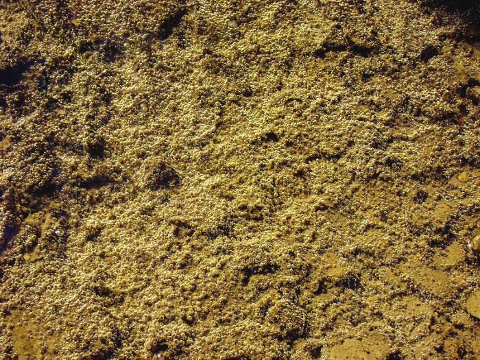
Please be careful in this next section! I lost the trail at one point but I did come across a couple very interesting scenes! As I crossed a little stream I happened to look down… Tiny bubbles! Don Ho! I thought it was incredibly interesting to see these and I wondered what might have caused them… If anyone could enlighten me I’d be grateful.
I then took a left at the next unmapped Bridle Trail intersection and made an interesting stream crossing…
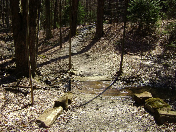
The last part of this Hinckley Hills Loop is completed
by taking a left over a couple large rocks at a sign which indicates that no
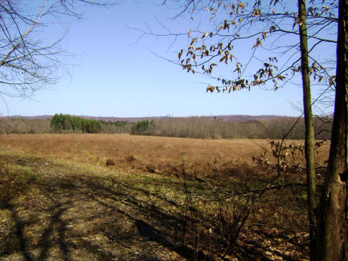
horses are allowed. You’ll next return to a very
familiar spot alongside a large field and you can return to your car
if like. You’ll have come about 2.5 miles by this point, but if you want
to continue you'll take a right and retrace your steps back to the aforementioned “T”
intersection and make a left to start a new section.
This is the Bridle/Buckeye Trail combo once again, but you’ll now be going the opposite direction of what you did earlier. This, again, is a very wide and well-trodden path that takes you along the northern side of a ravine carved out by one of the streams that runs through the preserve. This can be a very contemplative section and you can afford to take your attention off the trail a bit to engage in this pursuit – but only a bit because you'll have to watch out for the occasional horse manure!
At any rate, you’ll soon make a stream crossing and then
take a right at another “T” intersection. You’ll later return here to go in the opposite direction – left – so you’ll probably want to keep this in
mind. In fact, you’re eventually going to retrace all of the
steps you’re about to make in this next section.
I made the right in search of the Ledge Lake Loop
Trail. It’s marked with a squirrel and it quickly breaks off
to the right just as the Bridle Trail makes a “hairpin” left.
Here you’ll begin what will turn out to be your steepest ascent of the day up
the opposite (southern) side of the ravine you’ve just been walking along. You’ll get some pleasant views below…
Eventually cresting out, you'll link up with another unmapped Bridle Trail intersection and then take a right to begin another leg of your ascent. On your left you’ll notice a very pleasant looking moss covered rock garden accompanied by a white raccoon sign. This is actually the Worden’s Ledges Loop Trail which, as per the map, wasn’t supposed to crop up until much later. I figured I’d go ahead and explore it...
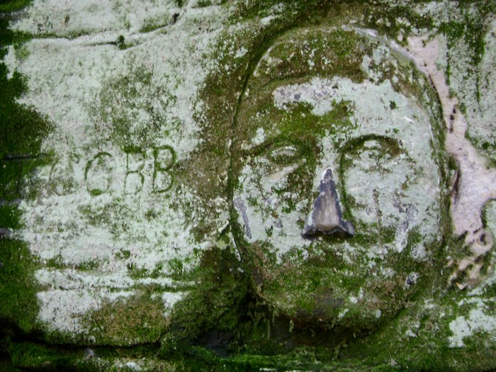
Well I, myself, did not find this to be a loop trail at all. The path seemed to die out at the end and I tried two directions, both of which merely had me blazing a new trail. I was not going to do this. I made it an out-and-back path. You will, however, encounter some incredibly interesting rock carvings here! As per what I’ve read these were made by a man named Noble Stuart in the 1940’s. I was able to spot a sphinx, a schooner ship, Ty Cobb, another face I didn’t recognize and an “H. M. Worden” along with what I assumed was a portrait of this person! Here's an interesting link.
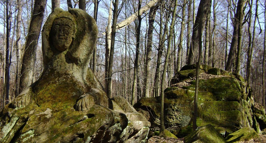
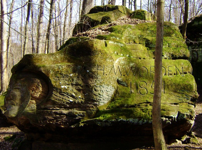
At
first I thought that this H. M. Worden was the artist, but in searching I found
that
Worden was actually the father of Noble Stuart’s wife, Nettie (whose name you
will also find carved here). Worden was also the owner of
this land - and guess who he purchased it from? Yep! Samuel
Hinckley – the namesake of this preserve! Stuart must have
found these rocks to be the perfect medium upon which to etch the images of some
things which impressed him most.
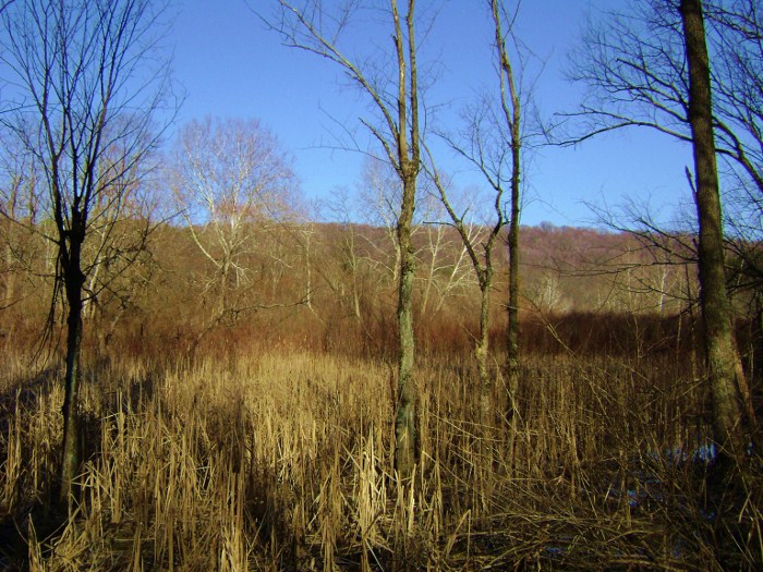
Upon emerging from the Worden Ledges Trail I went left and over a bridge further up the path to continue on the squirrel-marked Ledge Lake Loop. Doing so, I made another little climb and crested out on a ridge top which was relatively free of trees but not of thickets. These were very tall and dense and they provided an interesting contrast to what I’d thus far seen. There was a picnic table here too upon which to rest or have a break for lunch.
Afterward the trail very
quickly began to descend and I really began to wonder where it might lead me.
I’d completely given up on the map at this point and, as if to confirm
this, I was to encounter another couple of unmarked trails breaking off to the
right before I ended my descent. What I seemed to be doing here was hiking along the form
of a backward question mark down a hill and then around an embankment built for Ledge
Lake. Thus,
Ledge Lake Loop Trail was - for all appearances - just plain Ledge Lake
Trail. Like Worden Ledges, it appeared to essentially be an
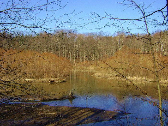
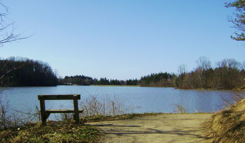
out-and-backer and not a loop at all. Anyway, I stopped to enjoy the lake for a while before retracing my steps
back up the hill. This little lake is quite picturesque and very popular.
Anyway, when I got back up to the point where I’d gone over the bridge near the Worden Ledges cutoff I tried making a right before heading back down. I was curious to see where this path ended as the indications were that it was part of the Wordens Ledges Loop Trail – the one that had previously seemed to peter out at the end after going past those carvings.
In the end I again found myself at the southern edge of
the park in a spot that must have been the Worden Ledges Trailhead. There was
a great old farmhouse here. Was this the Worden Heritage
Homestead? Probably, but the indications were that the trail
went right through the back yard and as this house looked like was occupied I headed back downhill. I make it a habit never to
tread on private property. I instead headed back
downhill and then straight toward the lake
on the Bridle Trail. It was time for the Hinckley Lake Loop.
I crossed the park road, briefly linked up with the
paved all-purpose trail, and then made a right onto a dirt path which would
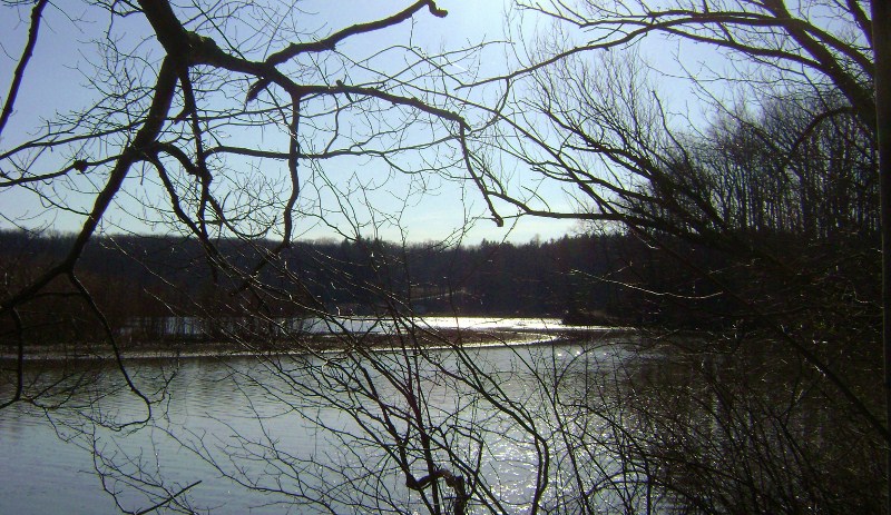
eventually take me all the way around - and directly beside - Hinckley Lake.
Hinckley is actually a dammed-up portion of the East Branch of the Rocky
River and if you, too, decide to follow the trail in this direction you’ll first
be led back toward the headwaters (or the origin waters of a stream).
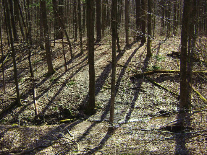
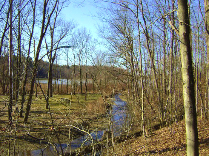
These lowlands make for some great picture opportunities as you’ll pretty
much be walking through a little swamp. This hike really runs
the gamut of environments!
*** Y’know, I’ve just noticed
something interesting… I’m sitting in a Barnes and Noble composing
this and I’ve just now sighted a great poster on the wall depicting an artist’s
rendering of a scene from Henry David Thoreau’s Walden. We
share some things in common, Thoreau and I – and you probably do too if you’re
into nature. It makes me wonder what similarities Walden Pond might share with Hinckley Lake
(although I know Thoreau had much more isolation at Walden Pond)?
***
Anyway, at first you’ll be overlooking the swamp-like
origin waters…
Then you’ll be right down in them…
Take a left to briefly link up with the all-purpose
trail again, cross over the water and then make another quick left back onto the
Hinckley Lake Loop Trail. Here you're following the
northern shoreline of the lake on a pleasant stroll – sometimes directly
alongside the bank and sometimes on a higher plane – but at one point you’ll
make a little climb and the path will seem to end. Instead,
you’ll have to cross a park road and make a final link-up with the all-purpose
trail which will eventually take you back around to your car.
I cut through a large parking lot and went over a bridge over the spillway. You’ll recognize this area as the point at which you entered the park. It’s a pleasant, fun filled spot complete with a little beach/swimming area - a great place to spend some time with friends or a loved one (pictures below were taken on a different day).
.JPG)
.JPG)
Today turned out to be a very enjoyable day!
I look forward to returning sometime to explore the eastern side of this
preserve.
DIRECTIONS: