Courthouse Rock/Double
Arch
Today was my
first fresh trip of the year (ie. a trip I’d never previously taken), and it
sure seemed like a long time coming! I thought I’d never see
the end of winter this year! I’d like to hike in the winter
too, of course, but I don’t have the vehicle for traveling the back roads in the
snow. Give me a jeep and I’d be out all the time!
Anyway, the
trip I selected for today was in the Red River Gorge for two reasons: it’s
pretty close
to
At this point
in the year I’m getting back into hiking shape by working my way up to my normal
distances in gradual steps. Step 1 is the 4 mile red trail at
the Raven Run Nature Sanctuary, followed a couple days later by
I drove to the
very end of
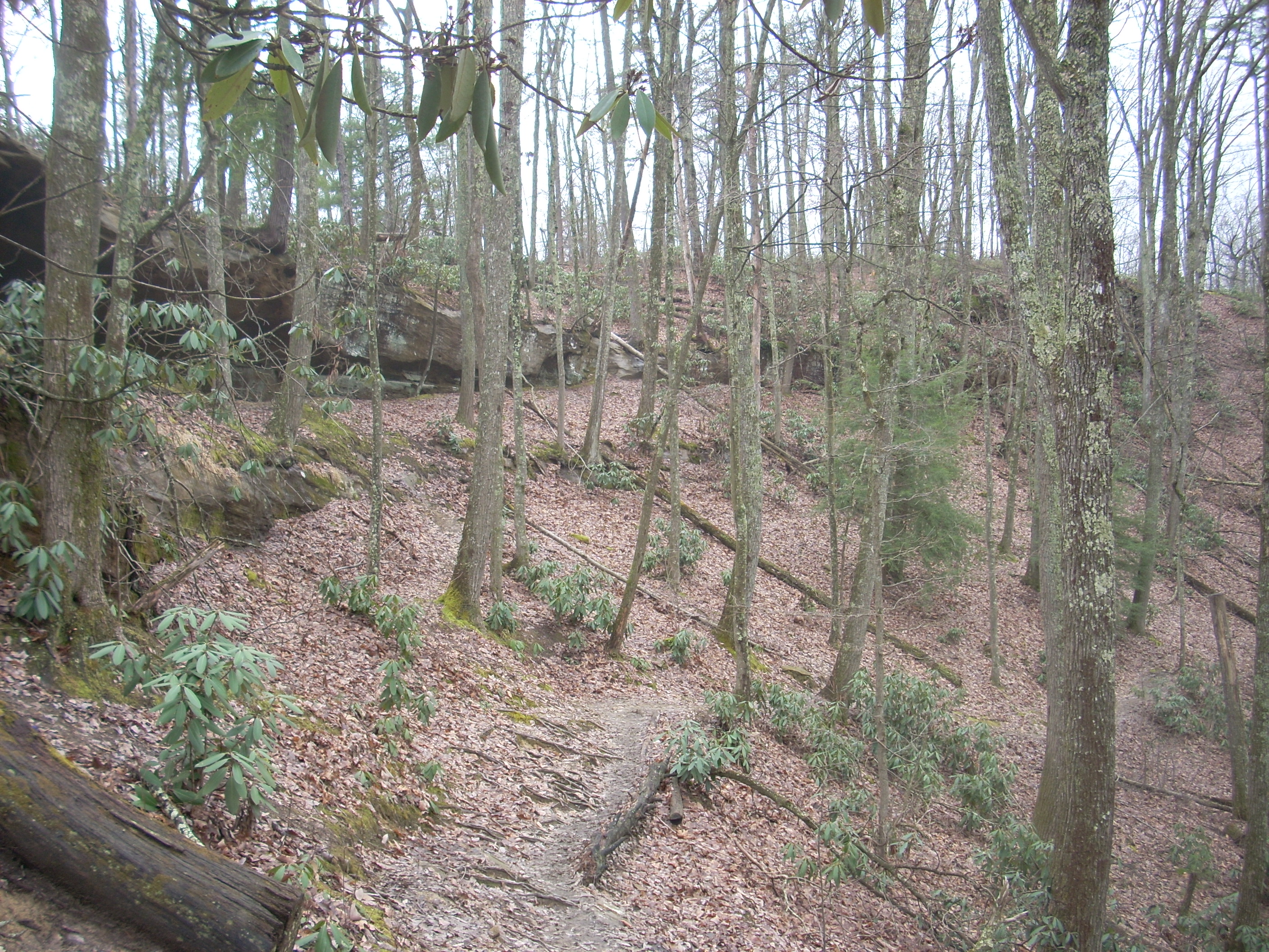
This hike begins on a level plane as it bisects a little forest of pines, and you’ll immediately be awed by the views on either side of you as the wilderness stretches far into the distance. Very soon the trail will curve left and begin descending this ridgeline. What you’ll do here is arch around a beautiful valley as you hike at the mid-level of this ridge, passing rock houses and other overhangs along the way. Then, ascending again on a sometimes sandy path, you’ll once again find yourself at the top of the ridge. Here you might stay for a while to enjoy many spectacular vistas.
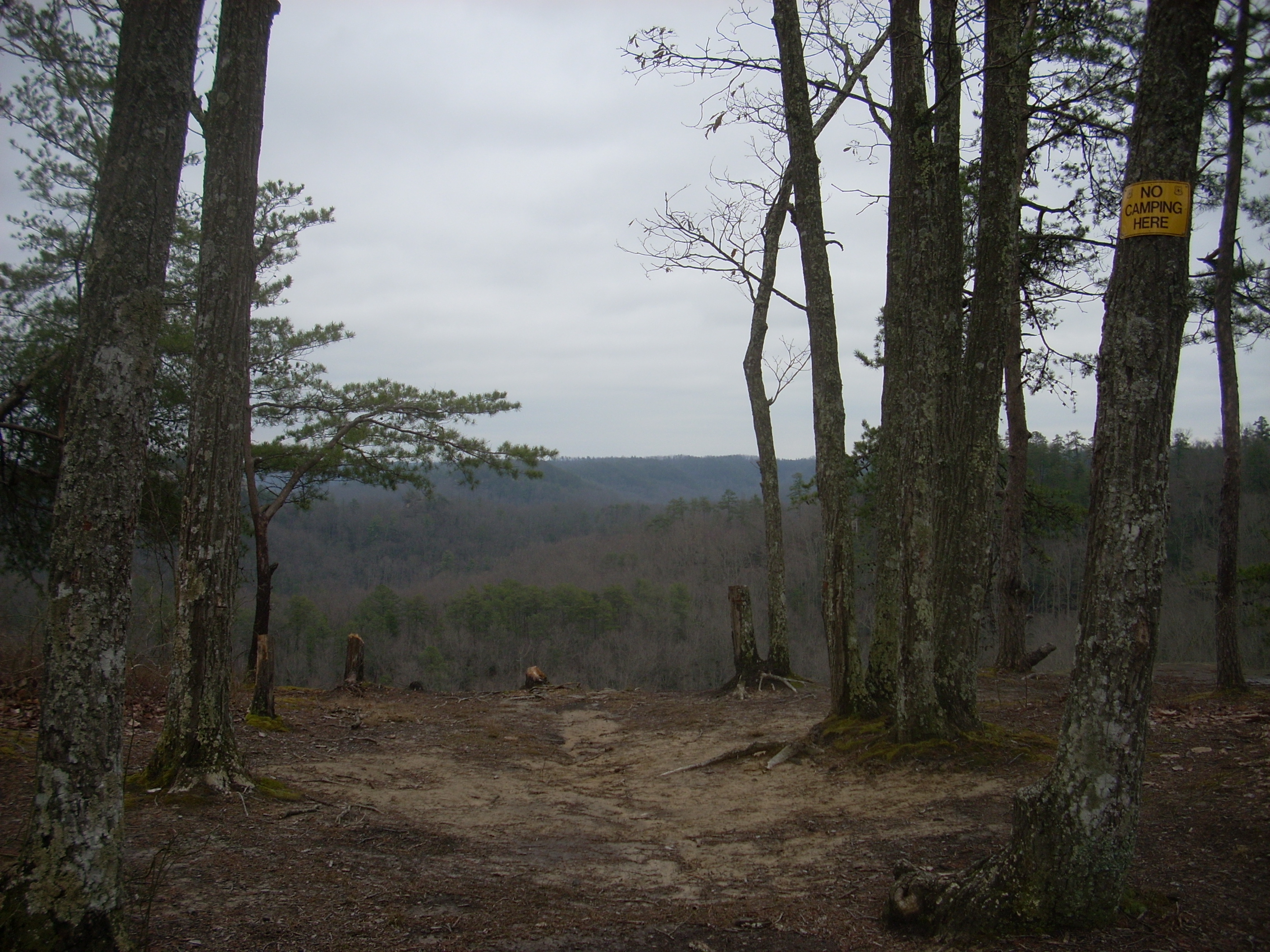
Presently you’ll reach an intersection in the path. This is the Courthouse Rock Trail which seems like it would be a perfect shortcut to said rock, but for the fact that it meanders so much. I continued on straight. There are a lot of sites in this section which seem to make incredibly nice camping spots but they’ve been roped off to allow for nature to reclaim them.
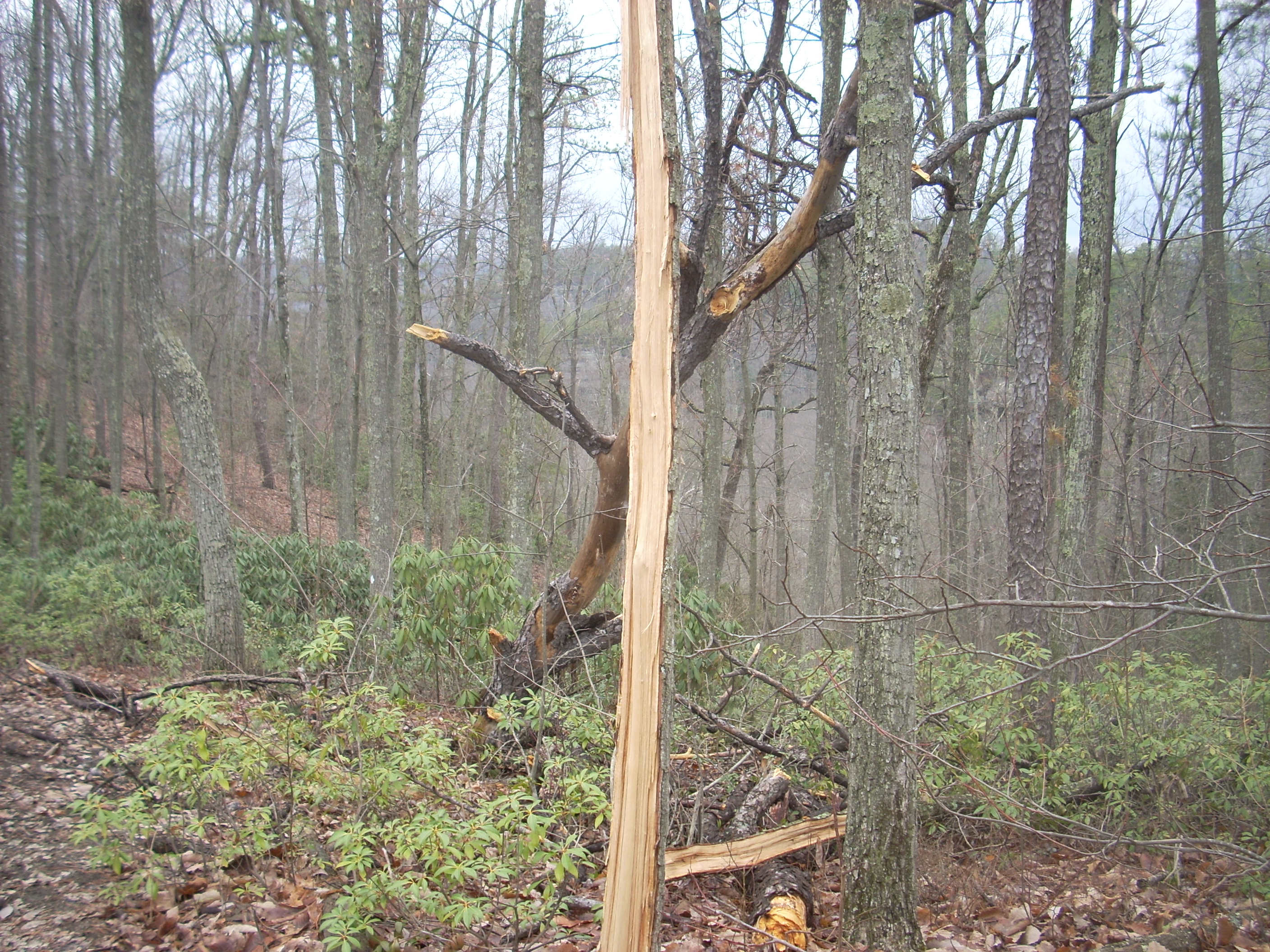
Another thing I noticed was a tree which had been perfectly split in 2, presumably by lightning.
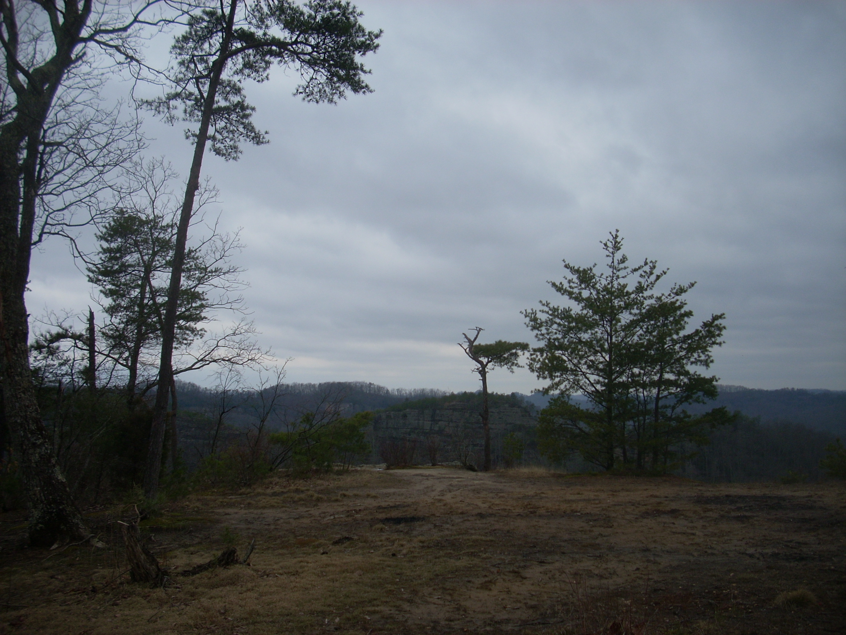
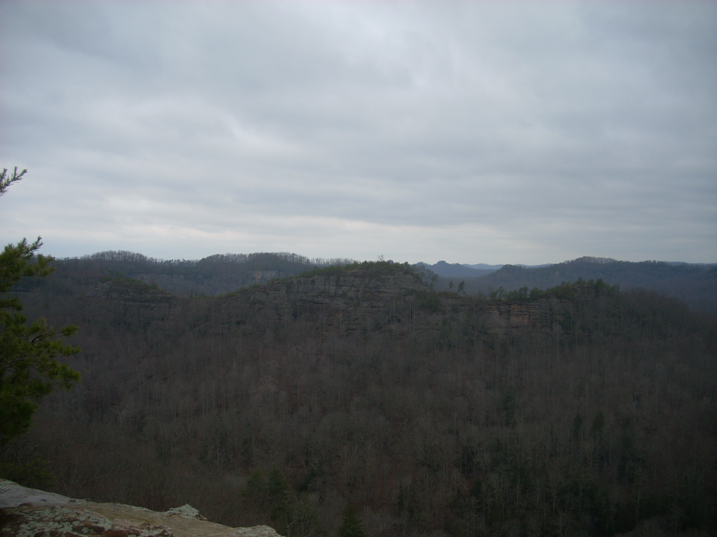
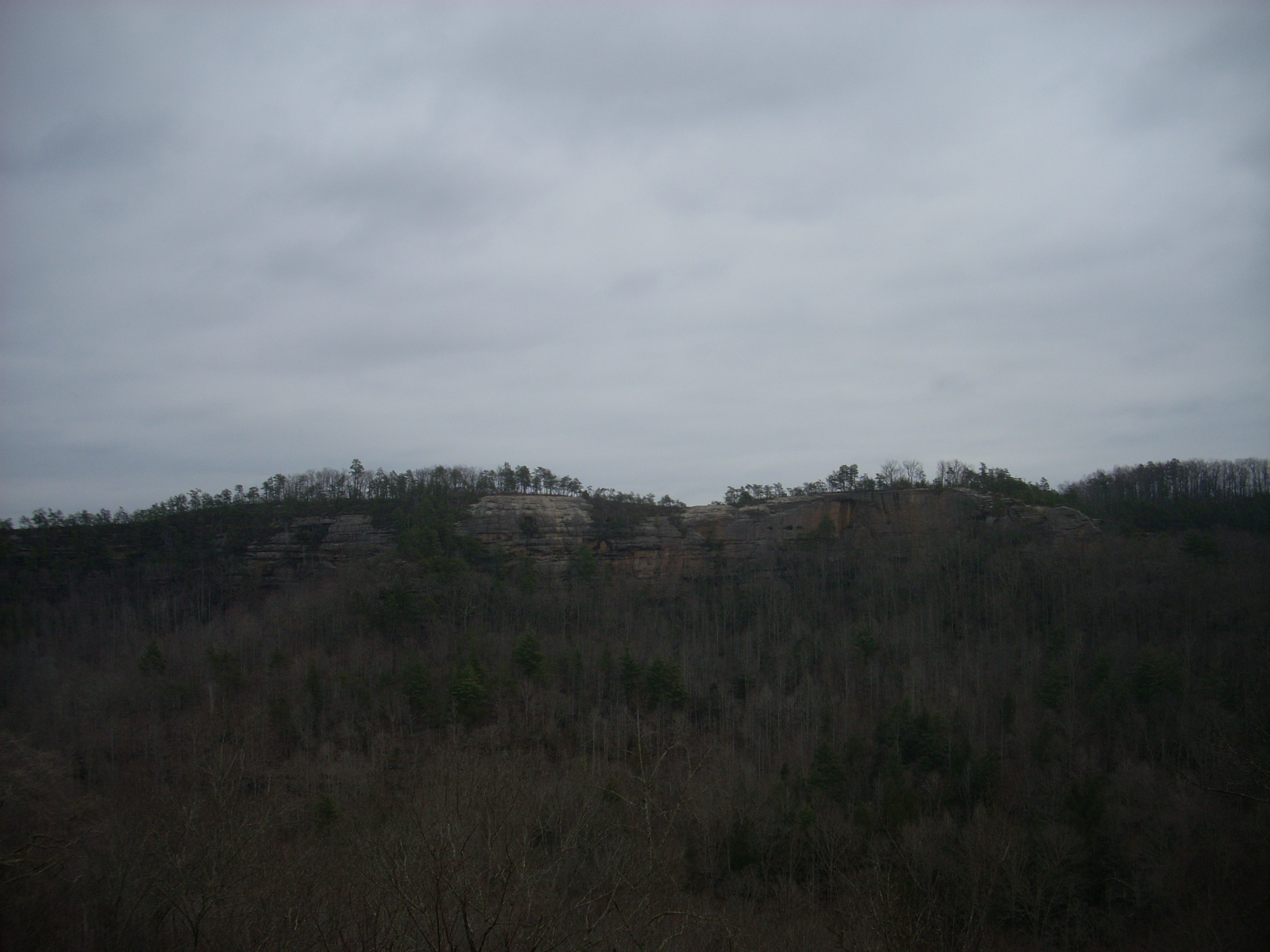
Continuing on atop the ridge, the next sight I met with was absolutely “out of left field” – semi-literally! It actually was a field – a field so large that several 18 wheelers might have been able to park upon it – and as I walked to the edge my eyes met with a view that was simply awe-inspiring. As clear as any of the views out at Berea College Forest (but without the farmhouses) the sights from this particular vista were completely unobstructed for almost 180 degrees. Here you’ll be able to gaze upon the gorge in all its’ glory. The spot reminded me a bit of Pilot Knob.
This,
incidentally, was the last point at which I’d hear the people who had been
behind me. For the first mile or so it had seemed like they
were “right there”, and for a time I was even to hear a car horn in the distance
about every 60 seconds (never know what kind of people will be out here!).
After I passed this point, however, it seemed like the group disappeared.
It was a bit odd. I thought they’d surely be right on
top of me after I’d taken the time to explore around Courthouse Rock further
ahead, but I wouldn’t even hear their voices echoing through the valley the rest
of the day as I was sure I would. In fact, the remainder of
the trip was quite peaceful.
Anyway, after stopping to enjoy this spot (it doesn't seem to have a name – The Panoramic Ledge, perhaps?) I continued on. I did lose the path once. It’s very easy to follow with the white diamonds on the trees but you might be distracted by all the incredible scenery.
As it continues the path turns sandy as it weaves along with a ridgeline that seems to form an “S” shape. At times this ridge top becomes quite narrow and it’s easy to see how it can wind up being so dangerous out here.
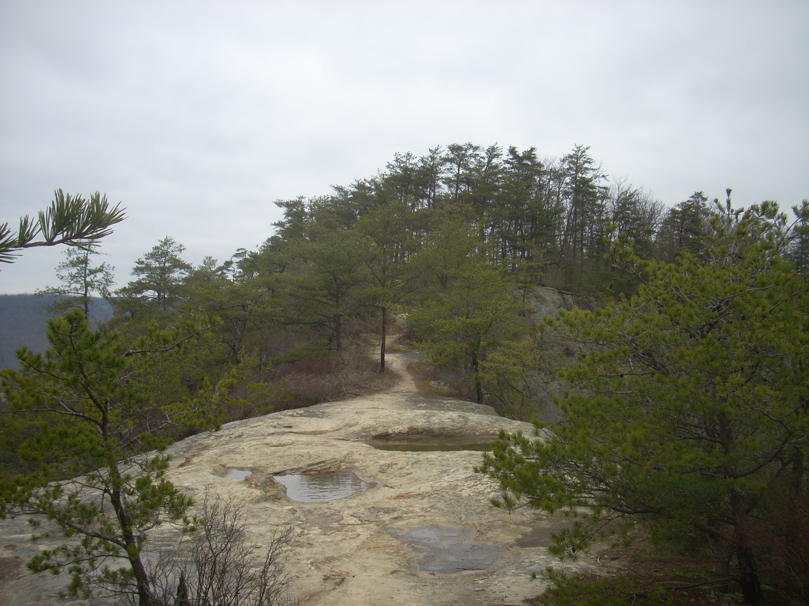
You’ll pass
some more vistas along with some interesting rock formations in this area.
These include a really nice one right before you begin your descent to Courthouse
Rock on a steep set of steps. What you’ll also spot is either
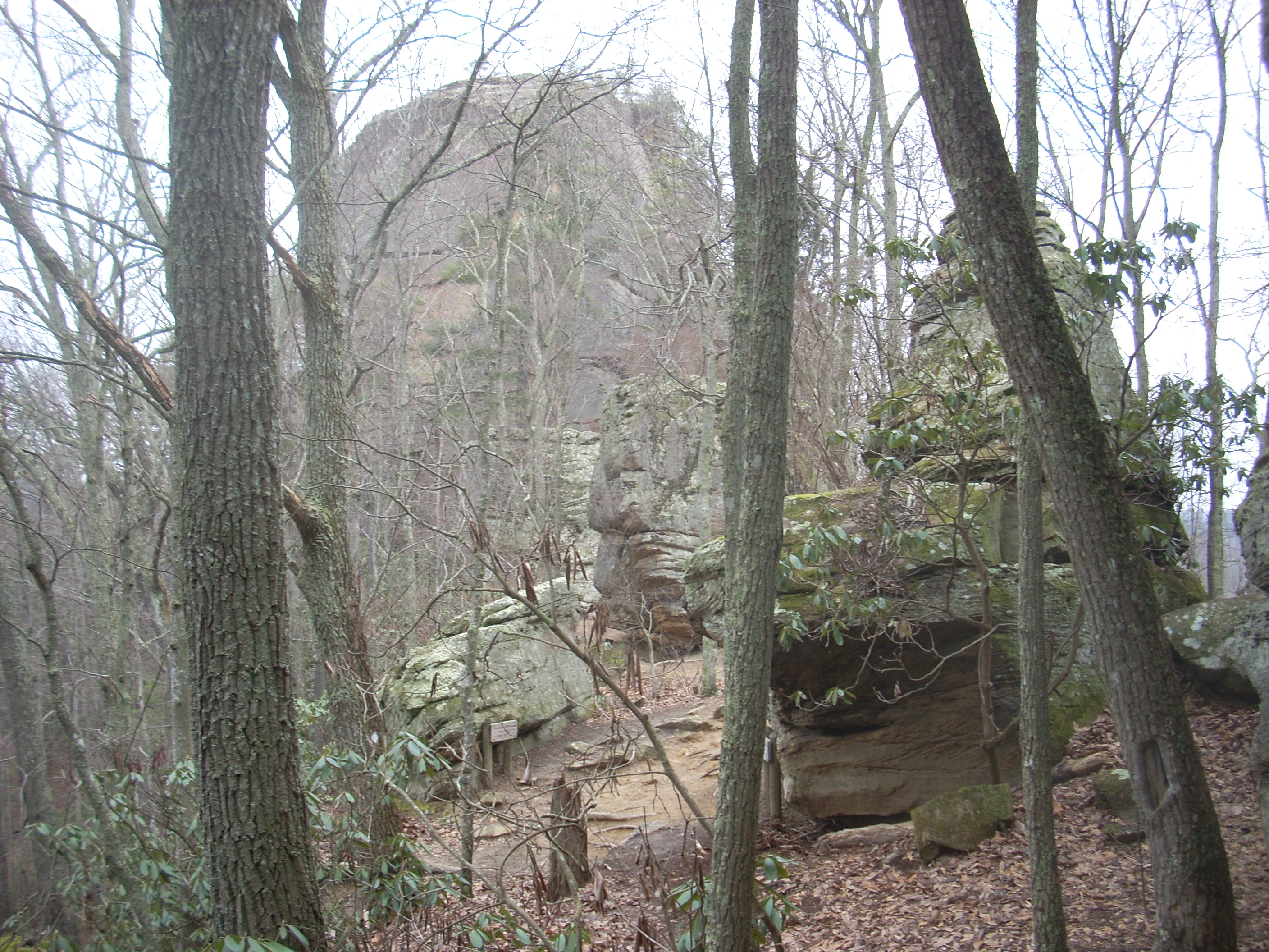
Once having reached it, the Courthouse Rock area literally looked like a playground full of large boulders. Courthouse itself was the largest, of course, but there were quite a few others. There’s a trail junction here too at which you’ll eventually head left, but go ahead and keep straight in order to reach the rock. I poked around here for a while, carefully climbing a little way up before moving on.
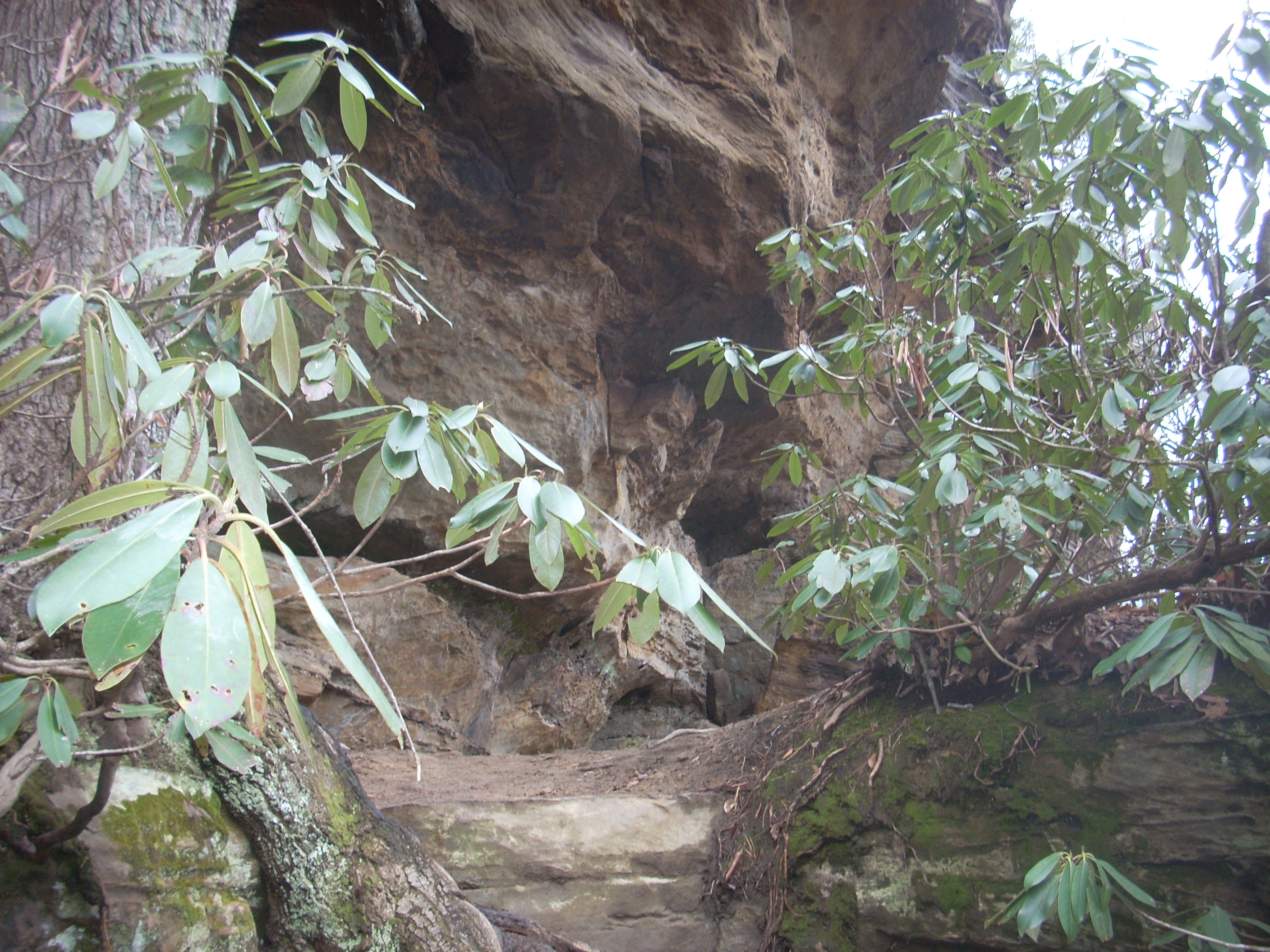
As I departed, the Auxier Trail led me down into the valley below the ridgeline I’d previously been traversing, and at one point of the descent there was a rock ledge/overhang which would have made an awesome camping spot. I got the picture below as I gazed upon this at about neck level.
Look high and
to your right and you’ll spot what will, incredibly, be your eventual
destination – Double Arch. You can’t mistake it.
As I looked at it I was thinking: “No way.
That certainly looks like an arch, but it’s so far distant!
Could that possibly be where I’m heading?!?” Turns
out, it was! It’s really quite remarkable when you take the
time to realize it, just how much distance you actually traverse on a hike.
In fact, once I’d reached the pinnacle of the arch itself this would
become even more graphically apparent.
The other end
of the Courthouse Rock Trail comes up soon. This is the trail
I mentioned before that kind of cuts through this large loop I’ve been making.
You’ll continue to the right, and as you descend further and further into
the valley you’ll reach the trails’ namesake – Auxier Creek.
These little streams are always so endearing to me as I listen to and become
soothed by the sounds of their gently trickling water. In fact,
as I headed upstream alongside the running water I imagined that my troubles were passing
through me and away down the waters of the stream as I walked in the opposite
direction, effectively leaving them behind. This left me with
a very light and airy feeling as I continued on, meditating upon this thought.
After a pleasant forest stroll the grade will strengthen uphill and as you ascend you’ll get the feeling that you’re about to have an up close and personal encounter with the rock face that lies just ahead of you. …and you pretty much will, because at the next trail junction you’ll head right and travel all the way around the base of this rock face. In point of fact, what you’ll actually do is form a coil around it as you wind your way up to the Double Arch. You’ll do a complete 360 around the actual base on a very gradual ascent, and then you’ll start on a second, tighter arc which will end at the arch itself. The arch itself? Stunning!
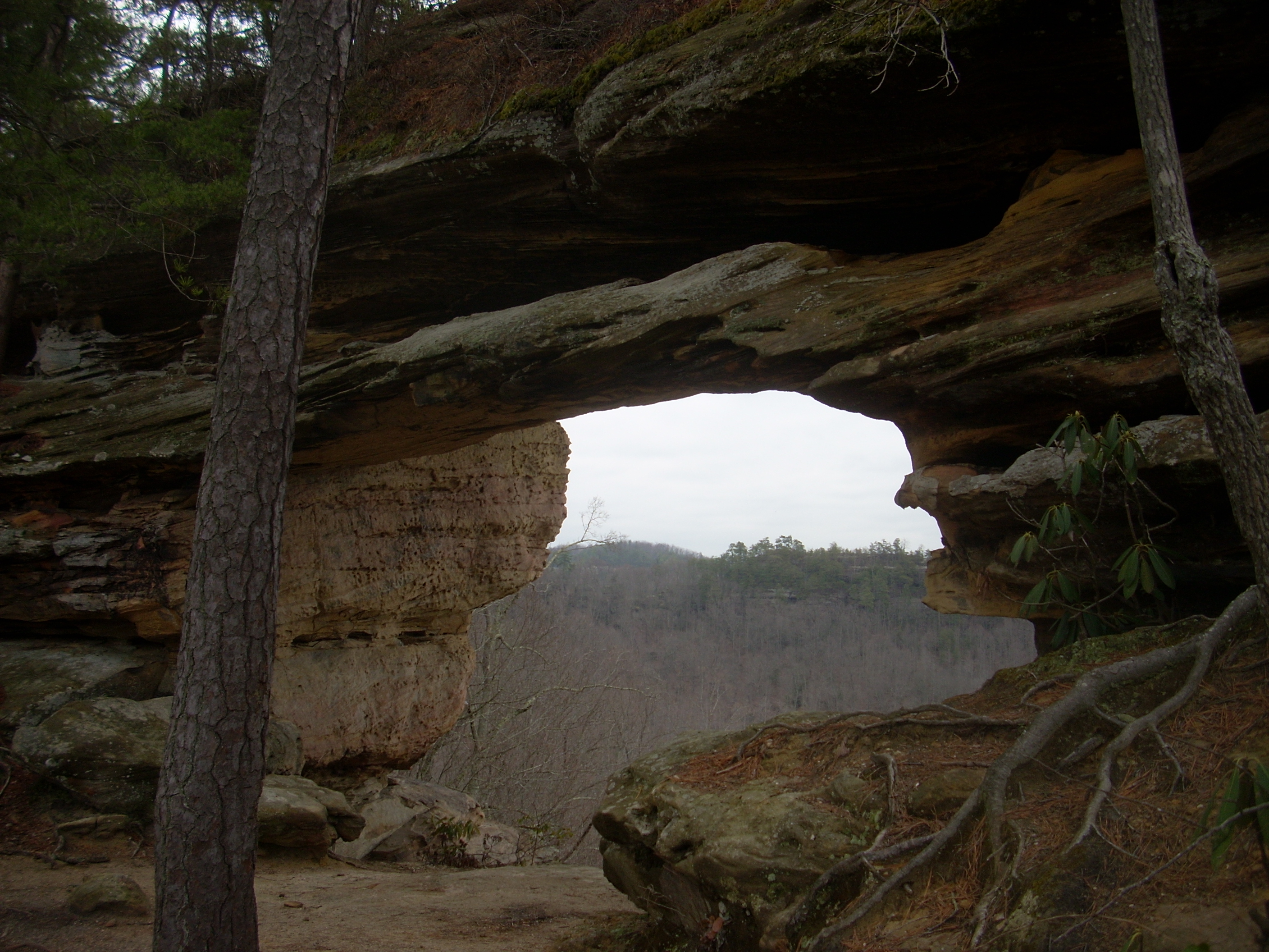
The views
through it and around it are as fine as you’ll see anywhere and you know what?
There wasn’t a soul around! I stayed for a while
snapping pictures right and left, but it wasn’t until I’d gotten almost all the
way back down that I realized: “What the bleep was I doing?”
There was absolutely no one around - full silence - and I don’t think I
took enough time to take it all in! I was too busy snapping
photo’s! I'd enjoyed it thoroughly, just not
enough. Isn’t that part of the human condition though - never
to be totally satisfied? In one way that’s kind of sad but
in another I’m reminded of what I hear on Sunday’s: “Our
hearts will always be restless until they rest in the Lord”.
I think that’s a much better perspective. ‘Nuff said.
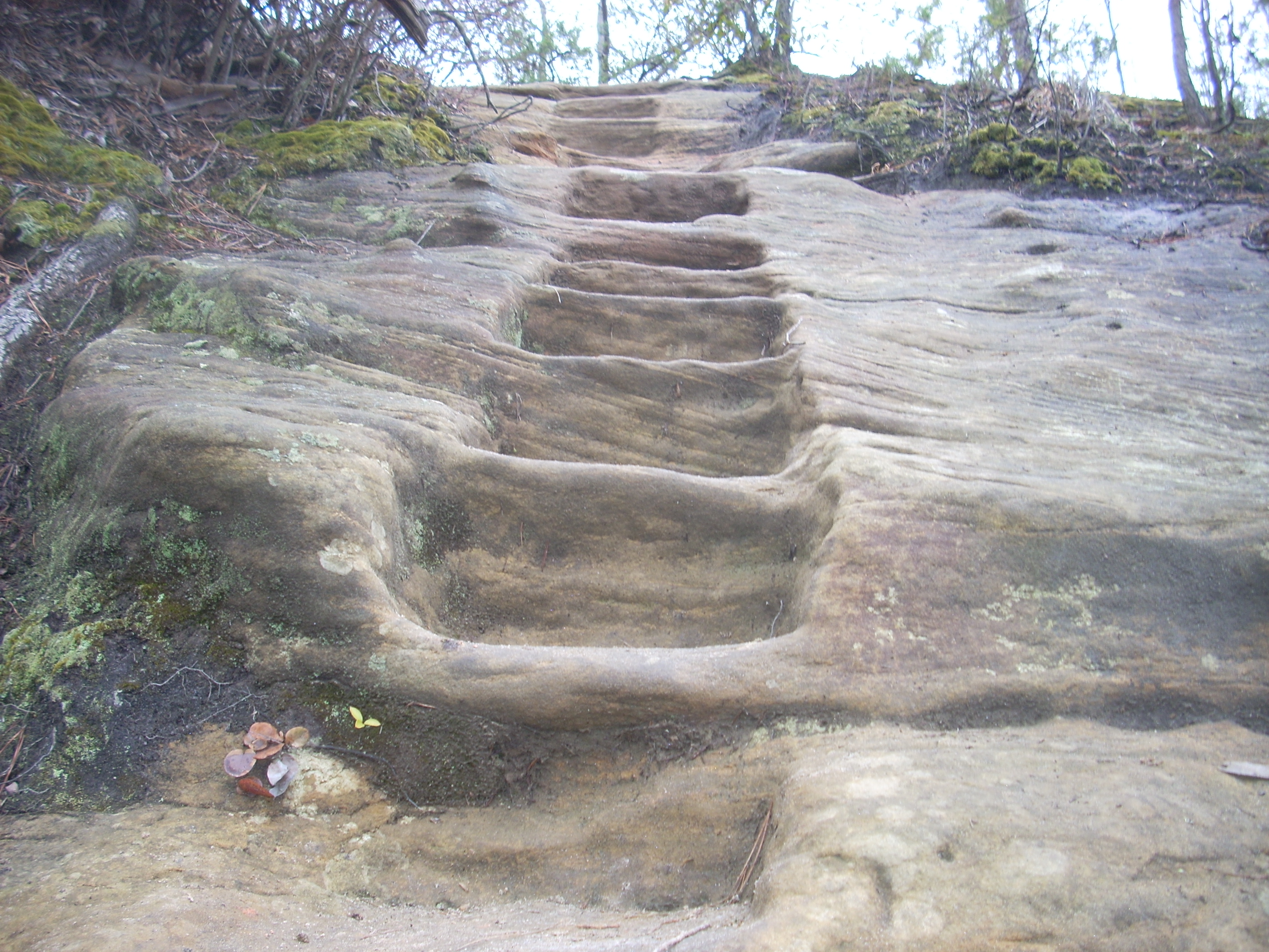
Around the right side of the arch you can climb up, and there are some steps carved right into the rock which will assist you in doing so. I thought these were really awesome and unique. This part is quite dangerous though. You really want to watch your footing up here. It’s a very narrow ridge top.
As you look out toward the ridge top across the other side of the valley you may realize that you were just over there! You’ll be able to see Courthouse rock too as well as the large field that I mentioned a while back. I think it’s really a neat feeling to see, in such a manner, just how far you’ve traveled!
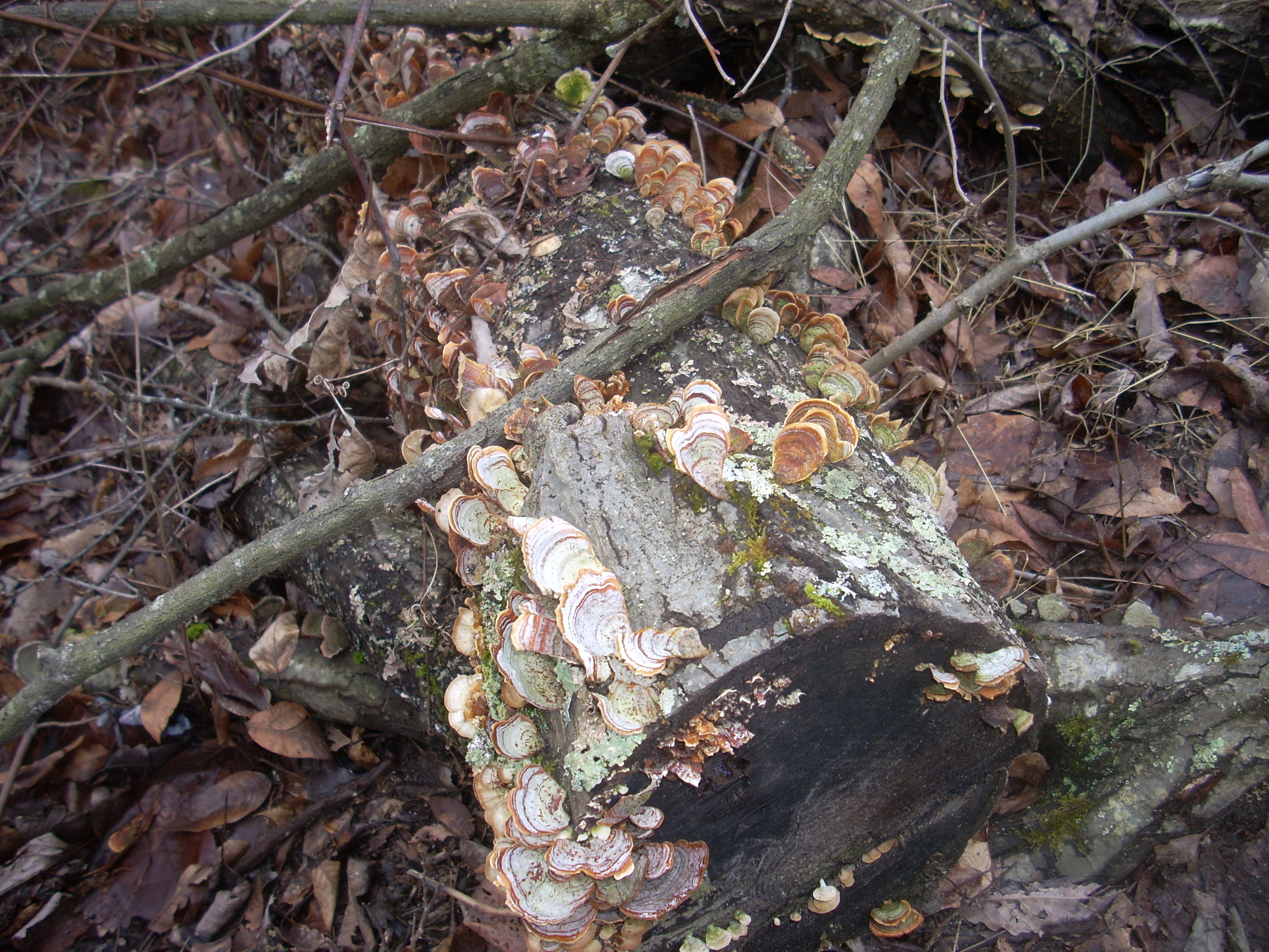
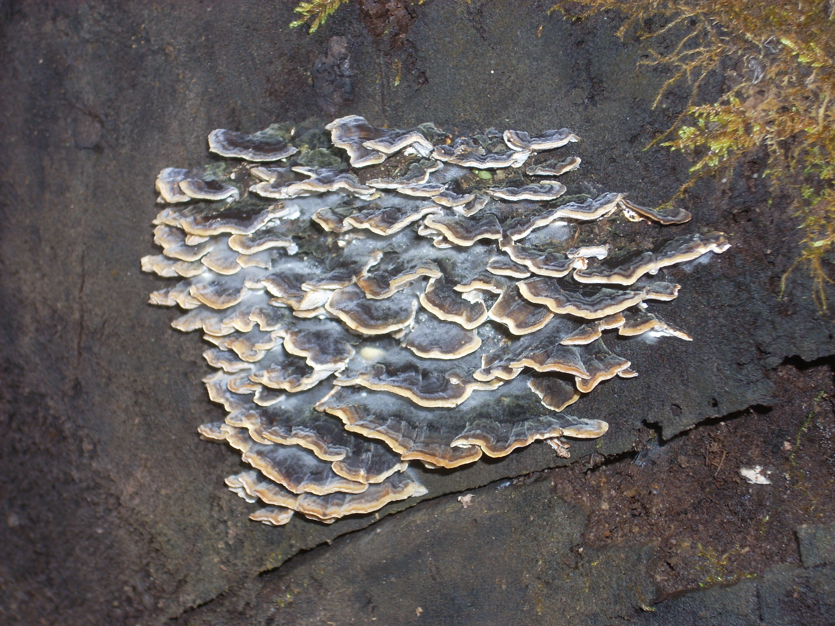
On the way back down (the hike up to Double Arch is an “out and back”) I noticed some incredibly colorful fungi on the downed trees I passed. Will you look at these?!? Fungi don’t get much respect, but I’ll tell ya - they can certainly surprise you sometimes! Some of these look like sea shells!
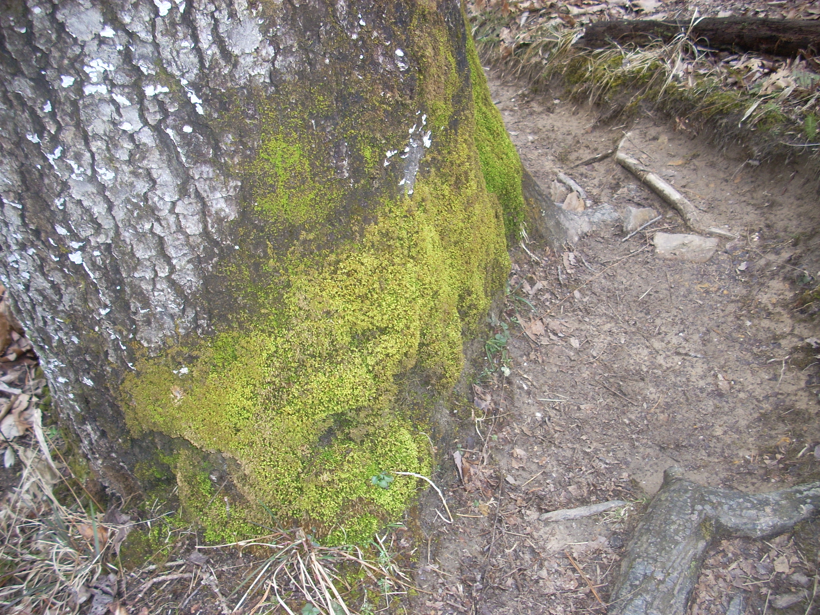
At another point I made out a face in the moss which looked to be yelling: “Hey!” Can you see it at the bottom just to the left of center?
Soon after this
I was to head back up and out of the valley on a steep set of switchbacks with
steps at the end. When I emerged I was looking at a road.
Turns out, this is the continuation of
One note on my drive back – I stopped at an area which looked like a really old scenic view location off KY15 (about half way back to the parkway and on the right if you’re heading in this direction). It was blocked by large boulders at the time, so I figured that something bad must have happened for it to have been closed. It looks like a lot of work had been put into its original construction, especially as regards the brickwork. I did see a cross signifying that someone had lost their life here, presumably in a motorcycle accident. I assume that this was why it had been closed?
DIRECTIONS:
Take exit 33
off the